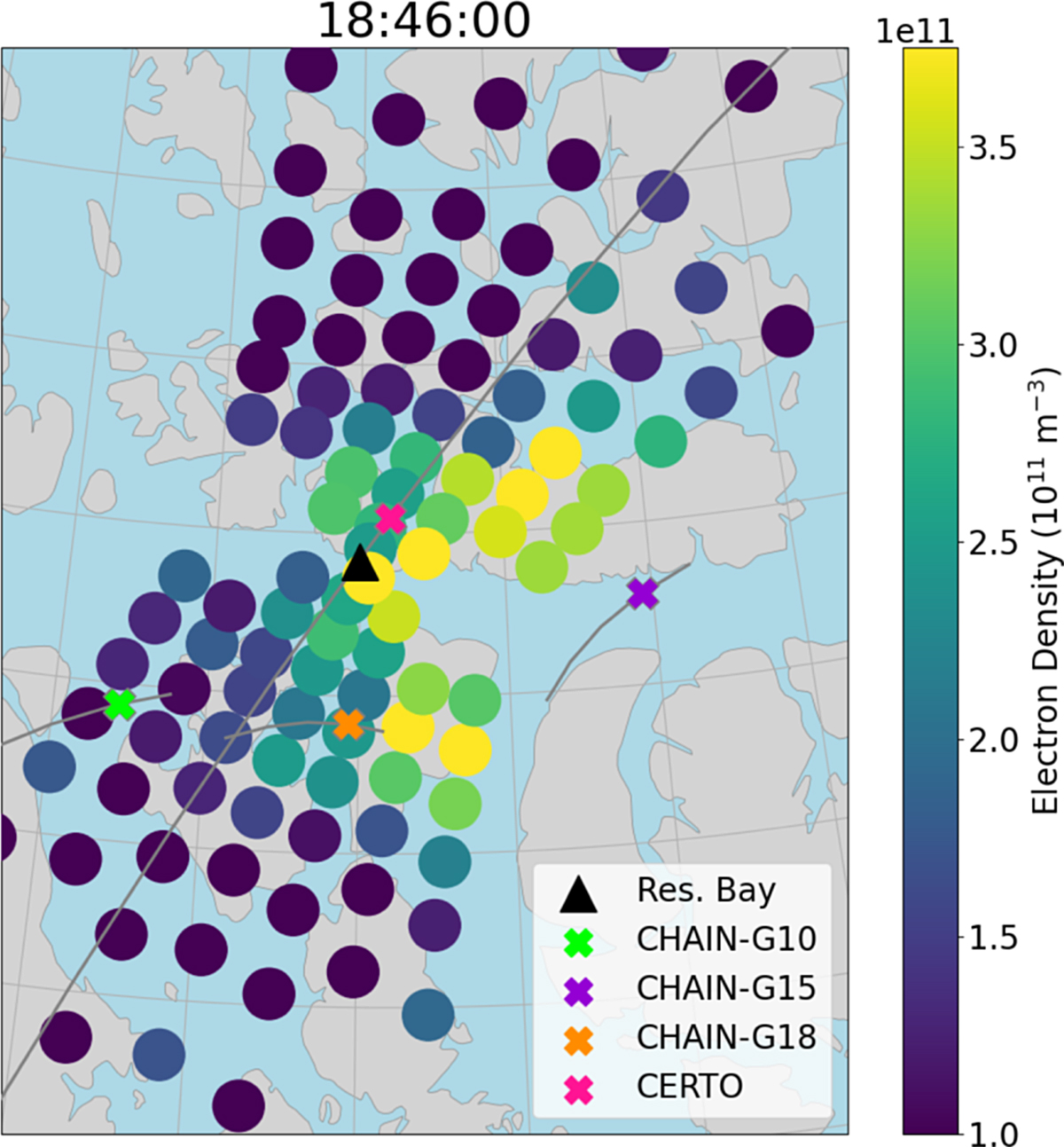
Fig. 1

Download original image
Polar patch considered in this case study as seen in the RISR FoV. RISR beam positions and measured densities at 300 km are shown, as well as the tracks from 18:00 to 19:00 (grey line) and positions at 18:46 (thick “x”) of the IPPs from the four conjunctions considered in this study. Both the CHAIN and CERTO receivers are located in Resolute Bay, but CHAIN detects signals transmitted by various GPS satellites while CERTO detects that from the CASSIOPE beacon. Included are CHAIN-GPS G10 (green), CHAIN-GPS G15 (purple), CHAIN-GPS G18 (orange), and CERTO-CASSIOPE (pink). An animation of the entire period the patch was observed is available in the Supplementary materials.
Current usage metrics show cumulative count of Article Views (full-text article views including HTML views, PDF and ePub downloads, according to the available data) and Abstracts Views on Vision4Press platform.
Data correspond to usage on the plateform after 2015. The current usage metrics is available 48-96 hours after online publication and is updated daily on week days.
Initial download of the metrics may take a while.


