Figure 5
Download original image
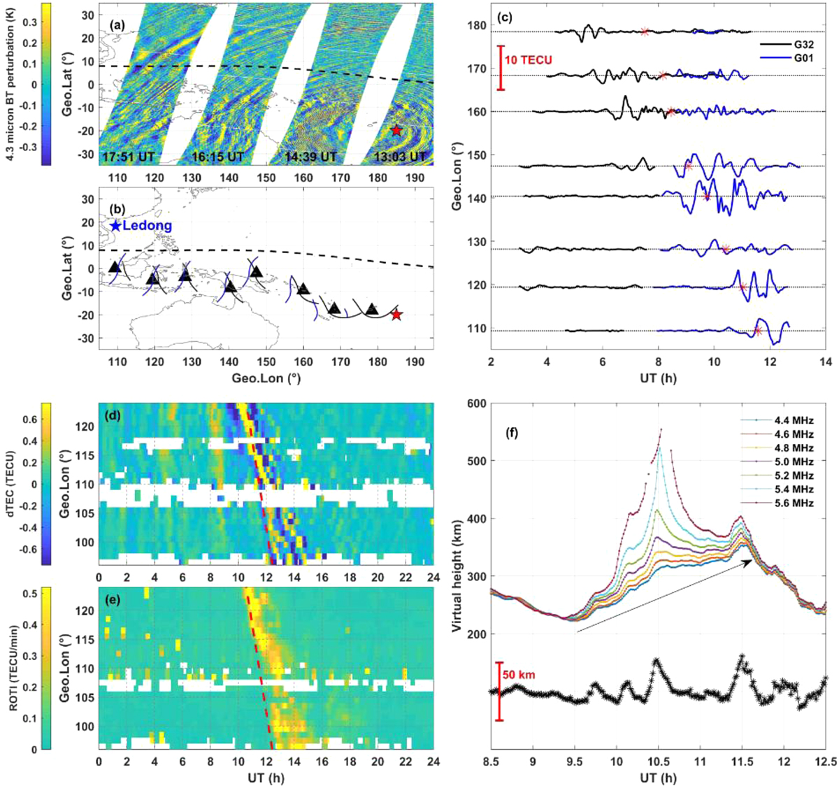
(a) AIRS observation of concentric stratospheric gravity waves in 4.3 μm radiance. (b) The geographic locations of GNSS sites (triangles) and IPP trajectories (black and blue solid curves) connecting Tonga to the magnetic dip equator conjugate to the East/Southeast Asia. (c) The dTEC obtained from the GPS satellites G01 and G32 for the GNSS sites in (b). (d) The dTEC and (e) ROTI at the Asian longitudes along the magnetic dip equator averaged using all the data at 0–15° N. (f) The plasma virtual heights at several selected frequencies derived from the Ledong ionosonde and the 60-min filtered virtual height at the plasma frequency 5.0 MHz (black asterisk curve). The red stars and black dashed curves in (a)–(b) mark the location of the Tonga volcano and the magnetic dip equator, respectively. The blue star in (b) marks the location of Ledong. The red asterisks in (c) indicate the E-region sunset at the location of each site. The red dashed curves in (d)–(e) denote the E-region sunset terminator. The black arrow in (f) indicates the elevation of the F layer bottomside.
Current usage metrics show cumulative count of Article Views (full-text article views including HTML views, PDF and ePub downloads, according to the available data) and Abstracts Views on Vision4Press platform.
Data correspond to usage on the plateform after 2015. The current usage metrics is available 48-96 hours after online publication and is updated daily on week days.
Initial download of the metrics may take a while.