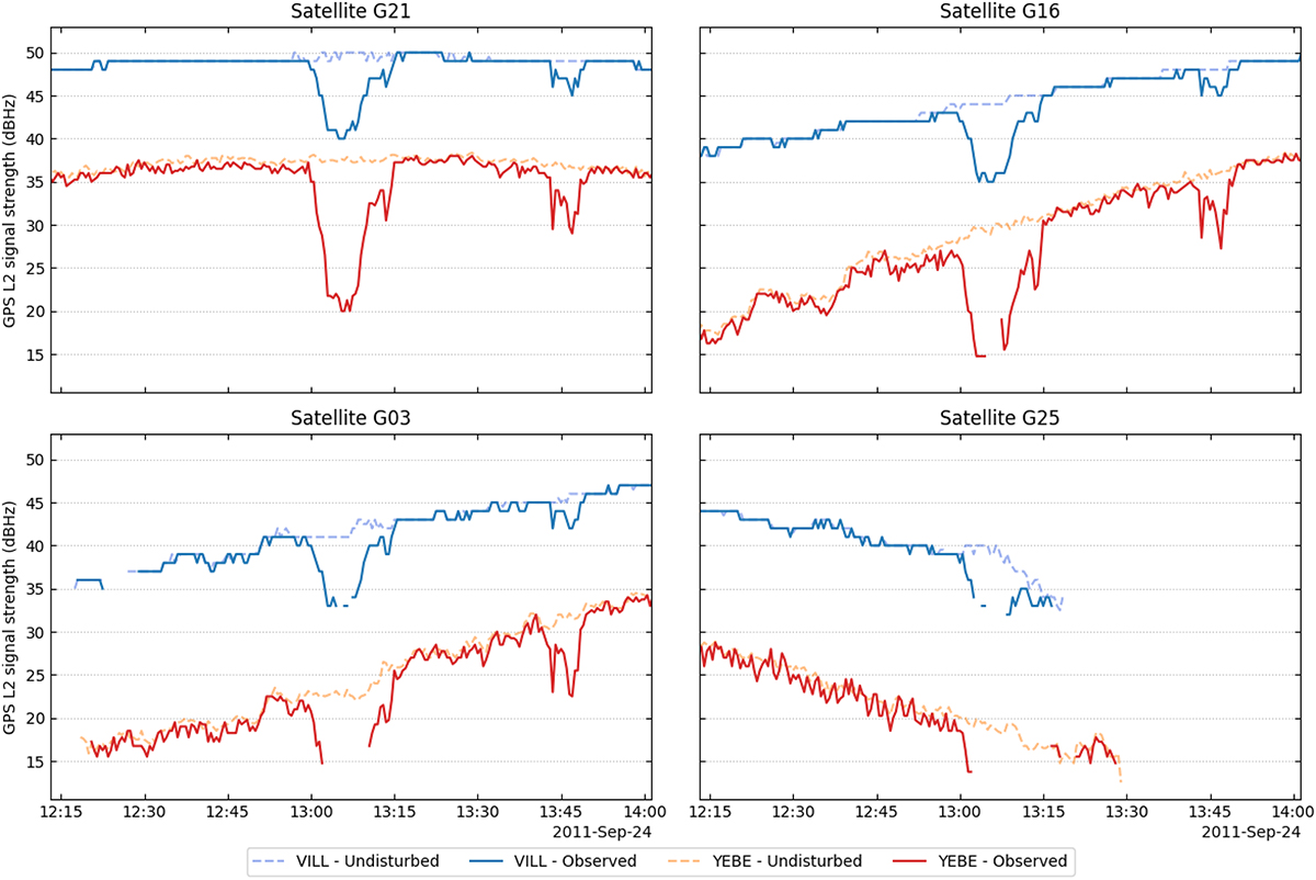
Figure 10

Download original image
GPS L2 signal strengths of four GPS satellites as measured at IGS station VILL (blue) and YEBE (red) during the SRB on 24 September 2011 (solid line) and according to the undisturbed reference (dashed line). The stations are separated by an approximate distance of 74 km. Their receivers are an Ashtech UZ-12 (VILL) and a Trimble NetRS (YEBE).
Current usage metrics show cumulative count of Article Views (full-text article views including HTML views, PDF and ePub downloads, according to the available data) and Abstracts Views on Vision4Press platform.
Data correspond to usage on the plateform after 2015. The current usage metrics is available 48-96 hours after online publication and is updated daily on week days.
Initial download of the metrics may take a while.


