Figure 2

Download original image
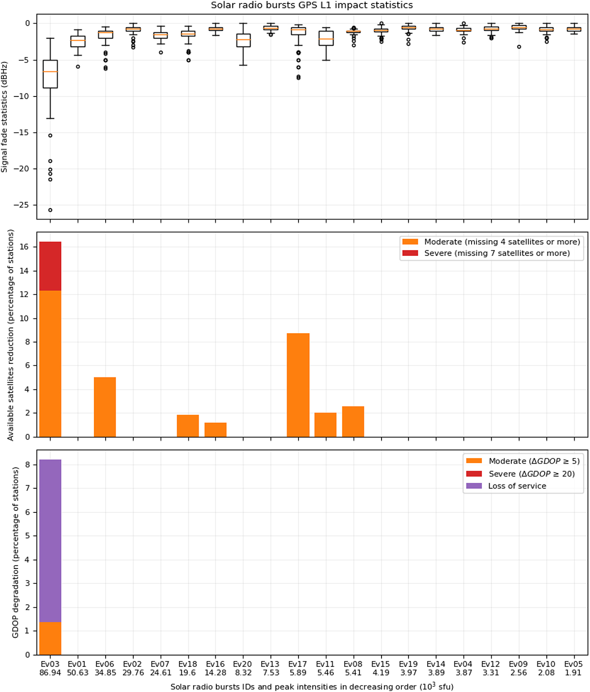
SRB impact statistics at the GPS L1 frequency in terms of signal fading (top panel), reduction in the number of available satellites (middle panel), and GDOP degradation (bottom panel). The signal fade statistics are shown as a box plot for each SRB (see text for details). The reduction in the number of available satellites and the GDOP degradation are presented as stacked bar plots showing the percentage of stations affected at different degradation levels. The SRBs are sorted with decreasing intensity on the x-axis (see Table 1 for SRB details).
Current usage metrics show cumulative count of Article Views (full-text article views including HTML views, PDF and ePub downloads, according to the available data) and Abstracts Views on Vision4Press platform.
Data correspond to usage on the plateform after 2015. The current usage metrics is available 48-96 hours after online publication and is updated daily on week days.
Initial download of the metrics may take a while.


