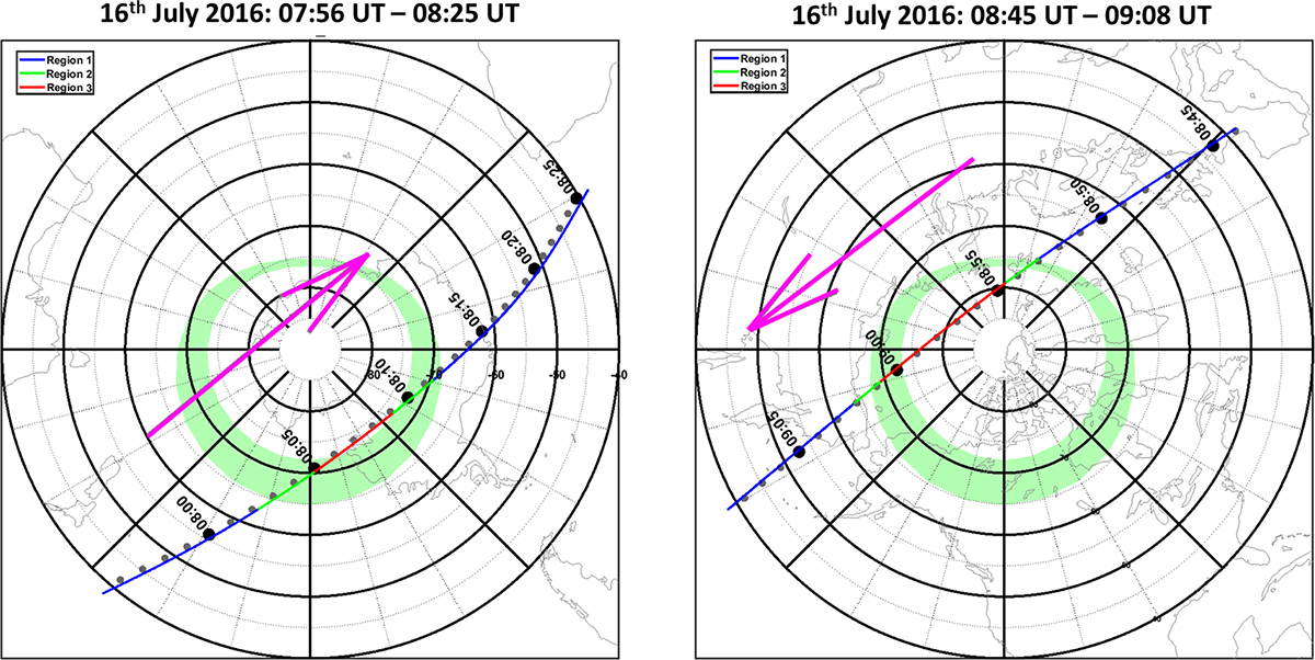
Figure 6

Download original image
The trajectory of the Swarm A orbit on 16th July 2015 between 07:56 UT–08:25 UT (left-hand panel) and 08:45 UT–09:08 UT (right-hand panel). The plots are centred on the geomagnetic south pole (left-hand panel) and the geomagnetic north pole (right-hand panel). The direction of the satellite motion is shown by the pink arrow. The satellite tracks are colour coded based on the ionospheric region flag in the IPDxIRR 2F data product, with blue representing region 1 (mid-latitude), green representing region 2 (auroral latitudes) and red representing region 3 (polar latitudes).
Current usage metrics show cumulative count of Article Views (full-text article views including HTML views, PDF and ePub downloads, according to the available data) and Abstracts Views on Vision4Press platform.
Data correspond to usage on the plateform after 2015. The current usage metrics is available 48-96 hours after online publication and is updated daily on week days.
Initial download of the metrics may take a while.


