Figure 9
Download original image
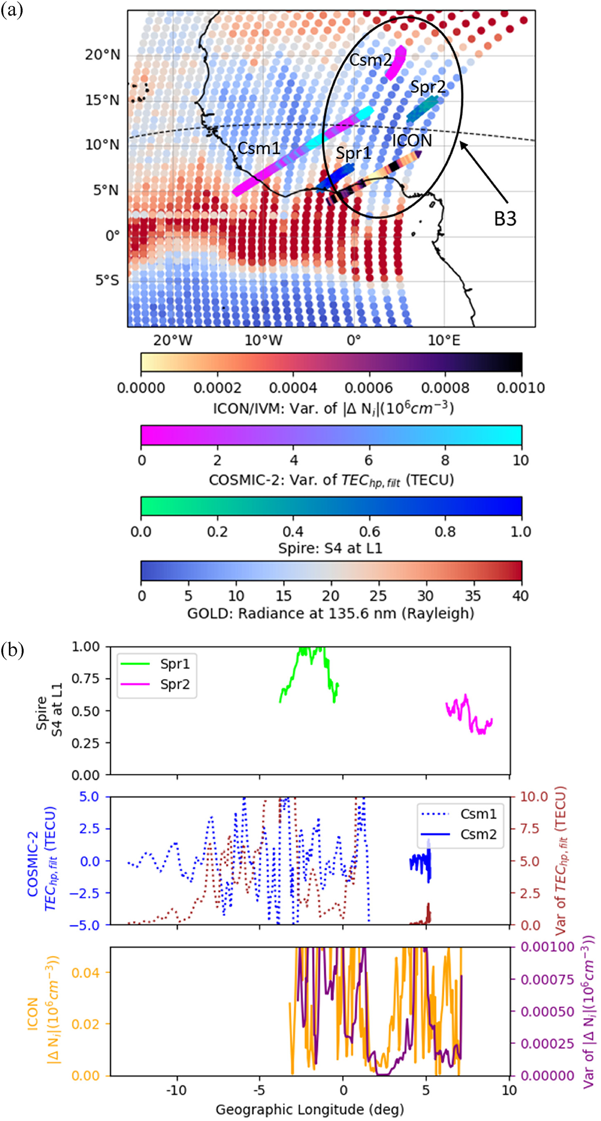
(a) Map with different sensor measurements color-coded and overlaid on the GOLD nighttime radiance image for perturbed Event 1 on 2022-08-17 between 20:50 and 21:10 UTC. The two Spire RO profiles are denoted as Spr1 and Spr2, and the COSMIC-2 profiles as Csm1 and Csm2. (b) Longitudinal variation of individual measurements mapped to 300 km reference altitude, as the GOLD data using the CHAOS model are plotted along the geographic longitude.
Current usage metrics show cumulative count of Article Views (full-text article views including HTML views, PDF and ePub downloads, according to the available data) and Abstracts Views on Vision4Press platform.
Data correspond to usage on the plateform after 2015. The current usage metrics is available 48-96 hours after online publication and is updated daily on week days.
Initial download of the metrics may take a while.