Figure 5
Download original image
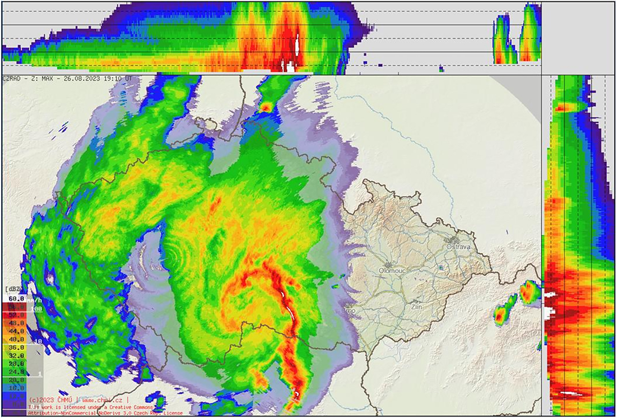
The Czech Weather Radar Network (CZRAD) composite of maximum reflectivity (dBZ, see the dBZ scale at bottom left) in pseudo-3D-view shows the structure of the MCS cloud. The image shows the maximum dBz at all heights and its horizontal structure. The side projections show the maximum dBz for a given direction and altitude (from 1 to 14 km, with solid lines at altitudes of 5, 10 and 14 km). This can be used to estimate the location and altitude of maximum radar reflectivity. The white areas correspond to the highest dBZ values (The circle artefacts around the radar location are the effect of the radar scanning and image processing technique.) (Setvák et al., 2010). Data source: Czech Hydrometeorological Institute, processing P. Novák.
Current usage metrics show cumulative count of Article Views (full-text article views including HTML views, PDF and ePub downloads, according to the available data) and Abstracts Views on Vision4Press platform.
Data correspond to usage on the plateform after 2015. The current usage metrics is available 48-96 hours after online publication and is updated daily on week days.
Initial download of the metrics may take a while.