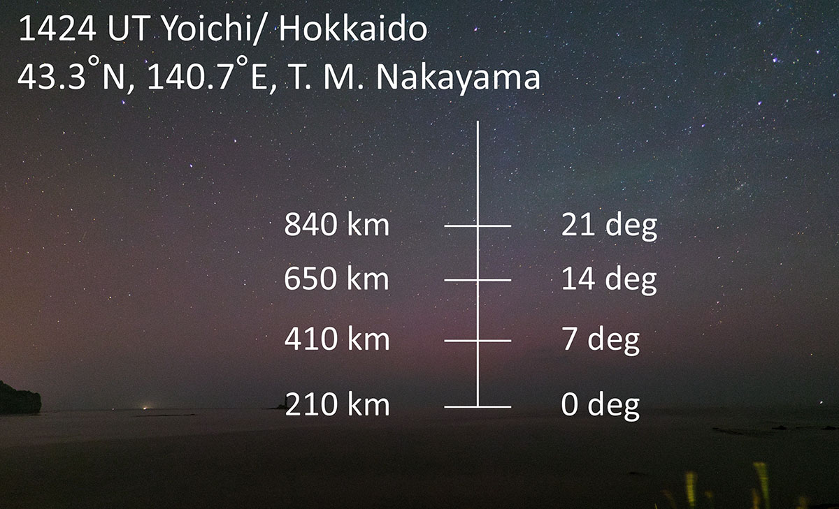
Figure 4
Download original image
The estimation of the auroral altitude of June 28 event. The elevation angles of the auroral body were derived from the photograph, using stars as reference points, and then mapped onto the image. These angles were projected onto the magnetic field line at the equatorward boundary of the auroral oval, as estimated from satellite observation. As a result, the altitude of upper portion of the aurora was estimated to be ~650 km at an elevation angle of 14°.
Current usage metrics show cumulative count of Article Views (full-text article views including HTML views, PDF and ePub downloads, according to the available data) and Abstracts Views on Vision4Press platform.
Data correspond to usage on the plateform after 2015. The current usage metrics is available 48-96 hours after online publication and is updated daily on week days.
Initial download of the metrics may take a while.